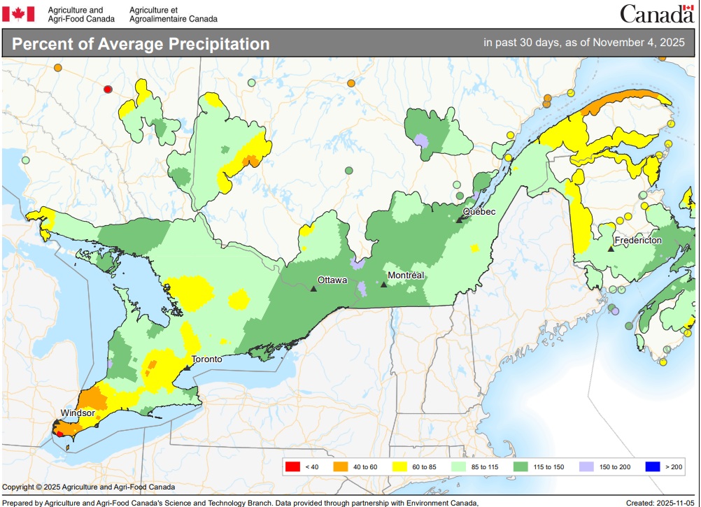
Eastern Ontario has received some much-needed relief from dry conditions over the past 30 days.
As shown on the map below, areas from about the midway point of Lake Ontario and eastward saw above normal precipitation in the 30-day period ending Nov. 5. However, at 115% to 150% of normal, plenty more moisture is likely still needed in most areas following a warm, dry summer and early fall.
Eastern Ontario and central Ontario were the regions most impacted by drought and dryness this year, with areas around Prince Edward County, Kingston, Peterborough, and the Niagara region particularly hard-hit.
While southern Ontario generally experienced hot and dry conditions, the impact varied regionally, with some areas receiving timely rain. However, eastern and central parts consistently saw below-normal precipitation, leading to severe to extreme drought conditions in some pockets as the summer progressed into fall.
According to the latest monthly Canadian drought monitor, eastern Ontario saw the expansion of severe drought in September, with three new pockets of extreme drought emerging north of Orilla, north of Peterborough and from Kingston towards Ottawa. Farmers reported major drought impacts, including reduced yields.
The October update of the drought monitor has not yet been released.