After a plentiful precipitation in December, the Prairies turned barren in January
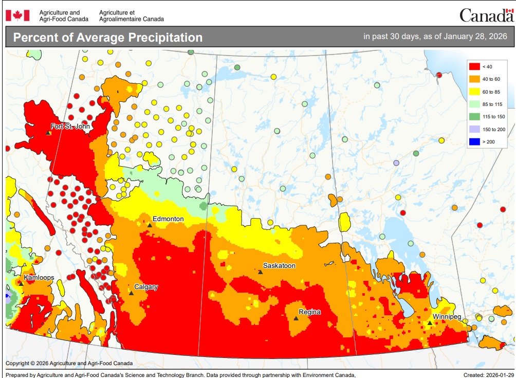
As can be seen on the map below, precipitation across much of the Prairies was far below normal in January, with Alberta seeing particularly scarce amounts. It marks a significant change from December, when most of Western Canada saw near to above average precipitation. In fact, parts of Alberta, including the Edmonton area, recorded some of their highest December precipitation volumes in decades, raising hopes for improved soil moisture for 2026 planting.
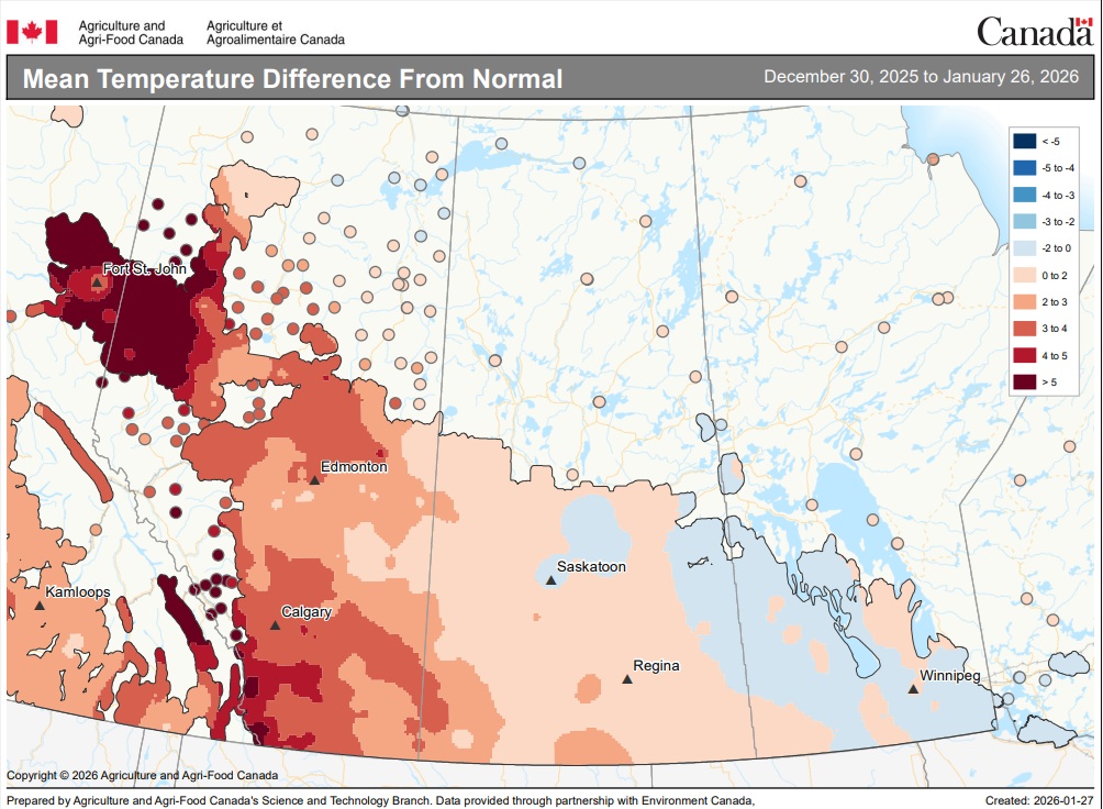
Meanwhile, not only was January mostly dry across the Prairies, but it also trended warmer than normal for much of Alberta and Saskatchewan (see map below). On the other hand, temperatures in Manitoba and eastern Saskatchewan were generally cooler than normal.
According to the latest monthly update of the Canadian drought monitor, abnormal dryness or some form of drought was impacting 62% of Prairie agricultural lands at the end of December. That was down from 71% at the end of November and below the October and September readings of 68% and 64%, as much of Canada received significant precipitation during the month.
However, long-term moisture deficits remain a challenge in several areas, especially in the southern Prairies.